

Riverwood topographic map
Click on the map to display elevation.
About this map

Name: Riverwood topographic map, elevation, terrain.
Location: Riverwood, St George, Sydney, New South Wales, Australia (-33.95721 151.04053 -33.93728 151.06552)
Average elevation: 22 m
Minimum elevation: -1 m
Maximum elevation: 62 m
Other topographic maps
Click on a map to view its topography, its elevation and its terrain.




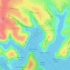





























Bents Basin State Conservation Area
Australia > New South Wales > Sydney
The park is popular for swimming, kayaking, bushwalking, camping (with 100 tent sites), barbecuing, picnicking and fishing. The park also features walking trails within a bushland and an education centre with a commercial kitchen. Caley's Lookout Track, a walking track within the bushland, leads to Little…
Average elevation: 82 m

