
Make a donation
Gear up for your next adventure:
As an Amazon Associate, this site earns from qualifying purchases at no extra cost to you.
Gem Lake topographic map
Click on the map to display elevation.
Make a donation
Gear up for your next adventure:
As an Amazon Associate, this site earns from qualifying purchases at no extra cost to you.
About this map
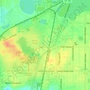
Name: Gem Lake topographic map, elevation, terrain.
Location: Gem Lake, Ramsey County, Minnesota, United States (45.04758 -93.05567 45.06850 -93.02804)
Average elevation: 289 m
Minimum elevation: 268 m
Maximum elevation: 309 m
Make a donation
Gear up for your next adventure:
As an Amazon Associate, this site earns from qualifying purchases at no extra cost to you.
Other topographic maps
Click on a map to view its topography, its elevation and its terrain.
Ford Dam Scenic Overlook
United States > Minnesota > Ramsey County > Saint Paul
Average elevation: 251 m
Make a donation
Gear up for your next adventure:
As an Amazon Associate, this site earns from qualifying purchases at no extra cost to you.