
Como Lake topographic map
Click on the map to display elevation.
About this map
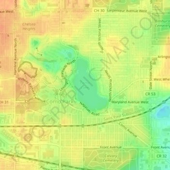
Name: Como Lake topographic map, elevation, terrain.
Average elevation: 280 m
Minimum elevation: 256 m
Maximum elevation: 293 m
Other topographic maps
Click on a map to view its topography, its elevation and its terrain.
Mississippi National River and Recreation Area
United States > Minnesota > Ramsey County > Saint Paul
Average elevation: 276 m
Como Park Zoo and Conservatory
United States > Minnesota > Ramsey County > Saint Paul
Average elevation: 282 m
Ford Dam Scenic Overlook
United States > Minnesota > Ramsey County > Saint Paul
Average elevation: 251 m