Geolocate

Hesten topographic map

Click on the map to display elevation.

About this map

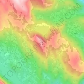
Name: Hesten topographic map, elevation, terrain.

Location: Hesten, Senja, Troms og Finnmark, Norway (69.41147 17.78555 69.41157 17.78565)

Average elevation: 263 m

Minimum elevation: 100 m

Maximum elevation: 457 m

Other topographic maps

Click on a map to view its topography, its elevation and its terrain.

Senja

Norway > Troms og Finnmark

Average elevation: 122 m

Gratangen

Norway > Troms og Finnmark

Average elevation: 350 m

Hasvik

Norway > Troms og Finnmark

Average elevation: 52 m

Silda

Norway > Troms og Finnmark

Average elevation: 90 m

Kvænangen

Norway > Troms og Finnmark

Average elevation: 447 m

South Varanki

Norway > Troms og Finnmark

Average elevation: 150 m

Hersøya

Norway > Troms og Finnmark

Average elevation: 22 m

Gear up for your next adventure:

🪑Ultralight Camping Stool - Compact seating for rest stops during long hikes
🥾Mountain Hiking Boots - High-traction boots for rocky terrain
🧴Waterproofing Spray - Restore the DWR coating on jackets and tents
🥾Trekking Poles - Adjustable trekking poles to reduce knee stress and improve stability
🔭Compact Binoculars - Lightweight optics for scouting trails and wildlife

As an Amazon Associate, this site earns from qualifying purchases at no extra cost to you.