Geolocate

Edmonton topographic map

Click on the map to display elevation.

About this map

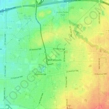
Name: Edmonton topographic map, elevation, terrain.

Location: Mill Woods, Edmonton, Alberta, Canada (53.43772 -113.46684 53.48769 -113.39361)

Average elevation: 698 m

Minimum elevation: 677 m

Maximum elevation: 725 m

Alberta trails, hiking, mountain biking, running and outdoor activities

Other topographic maps

Click on a map to view its topography, its elevation and its terrain.

William Hawrelak Park

Canada > Alberta > Edmonton

Average elevation: 649 m

McQueen Park

Canada > Alberta > Edmonton

Average elevation: 674 m

Horseshoe Lake

Canada > Alberta > Edmonton

Average elevation: 680 m

landslide

Canada > Alberta > Edmonton

Average elevation: 668 m

landslide

Canada > Alberta > Edmonton

Average elevation: 668 m

Ormsby Park

Canada > Alberta > Edmonton

Average elevation: 688 m

Gear up for your next adventure:

💡Compact LED Flashlight - Powerful and portable flashlight for outdoor use
🚲Bike Repair Kit - Essential tools for on-trail mechanical issues
Lightweight Camping Tent - Portable shelter optimized for Canadian backcountry camping
🔦UV Flashlight - Detect minerals or specific insects in the dark
Lightweight Backpacking Tent - Compact tent for efficient hiking trips

As an Amazon Associate, this site earns from qualifying purchases at no extra cost to you.