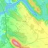
Oton topographic map
Click on the map to display elevation.
Oton
Oton is located 9 kilometers northwest from the city of Knin. It is scattered across a wide area between the canyon of Zrmanja river on the west and Radljevac river on the east. To the south, the border of the village is Debelo Brdo. The village is divided into Oton Polje and Oton Brdo according to its geographical characteristics and the altitude of its hamlets. The villages of Bender and Kobilice also belong to the Oton region. Oton Polje consists of the following hamlets: Dobrijevići, Karanovići, Kneževići, Mišljeni and Vujnovići, and Oton Brdo consists of the following hamlets: Atlije, Karne, Kneževići, Kovačevići, Opačići, Sudari, Rastovići, Višekrune and Žunići. Bender consists of hamlets: Dobrijevići, Čupkovići, Pašići and Runjajići.
About this map
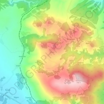
Name: Oton topographic map, elevation, terrain.
Location: Oton, Općina Ervenik, Šibenik-Knin County, Croatia (44.08085 16.10674 44.12085 16.14674)
Average elevation: 522 m
Minimum elevation: 333 m
Maximum elevation: 734 m
Other topographic maps
Click on a map to view its topography, its elevation and its terrain.


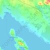
Grad Knin
Since records began in 1949, the highest temperature recorded at the local weather station at an elevation of 255 metres (837 ft) was 42.3 °C (108.1 °F), on 10 August 2017. The coldest temperature was −18.4 °C (−1.1 °F), on 17 February 1956.
Average elevation: 565 m


Grad Šibenik
Since records began in 1949, the highest temperature recorded at the local weather station at an elevation of 77 metres (253 ft) was 39.4 °C (102.9 °F), on 10 August 2017. The coldest temperature was −11.0 °C (12.2 °F), on 10 February 1956.
Average elevation: 135 m






Krapanj
Croatia > Šibenik-Knin County > Grad Šibenik > Krapanj
Krapanj is one of the smallest inhabited islands of the Adriatic Sea covering 0.36 km2. It is the lowest island on the Adriatic with an elevation of 1.5m above sea level. Krapanj is 300m offshore at its closest point from the mainland town of Brodarica.
Average elevation: 5 m