Geolocate

Palmyra topographic map

Click on the map to display elevation.

About this map

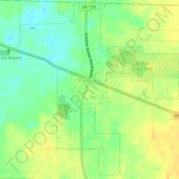
Name: Palmyra topographic map, elevation, terrain.

Location: Palmyra, Harrison County, Indiana, United States (38.39351 -86.12363 38.41935 -86.09279)

Average elevation: 236 m

Minimum elevation: 221 m

Maximum elevation: 249 m

Other topographic maps

Click on a map to view its topography, its elevation and its terrain.

Macedonia

United States > Indiana > Harrison County

Average elevation: 224 m

Frenchtown

United States > Indiana > Harrison County

Average elevation: 231 m

Hillcrest

United States > Indiana > Harrison County > Corydon

Average elevation: 200 m

Gear up for your next adventure:

🪑Insulated Seat Pad - Protect your seat from cold rocks and wet logs
🧦Hiking Liner Socks - Thin base layer to prevent friction and blisters
🛶Waterproof Dry Bags - Keep electronics and clothes dry during river crossings
🥾Mountain Hiking Boots - High-traction boots for rocky terrain
🔪Outdoor Multitool - Versatile tool for repairs and food prep in the wild

As an Amazon Associate, this site earns from qualifying purchases at no extra cost to you.