
Fairford topographic map
Click on the map to display elevation.
About this map
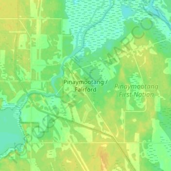
Name: Fairford topographic map, elevation, terrain.
Location: Fairford, Division No. 18, Manitoba, R0C 0X0, Canada (51.55240 -98.72468 51.63240 -98.64468)
Average elevation: 251 m
Minimum elevation: 242 m
Maximum elevation: 261 m
Division No. 18 trails, hiking, mountain biking, running and outdoor activities
Other topographic maps
Click on a map to view its topography, its elevation and its terrain.
Clear Lake
Canada > Manitoba > Division No. 18 > Rural Municipality of Grahamdale
Average elevation: 251 m
West Shoal Lake
Canada > Manitoba > Division No. 18 > Rural Municipality of St. Laurent
Average elevation: 262 m
Icelandic River
Canada > Manitoba > Division No. 18 > Rural Municipality of Bifrost – Riverton
Average elevation: 233 m