Geolocate

Morgongåva topographic map

Click on the map to display elevation.

About this map

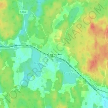
Name: Morgongåva topographic map, elevation, terrain.

Location: Morgongåva, Heby kommun, Uppsala County, 744 50, Sweden (59.91376 16.94270 59.95376 16.98270)

Average elevation: 70 m

Minimum elevation: 53 m

Maximum elevation: 95 m

Other topographic maps

Click on a map to view its topography, its elevation and its terrain.

Älvkarleby kommun

Sweden > Uppsala County

Average elevation: 20 m

Östhammars kommun

Sweden > Uppsala County

Average elevation: 10 m

Hargshamn

Sweden > Uppsala County

Average elevation: 5 m

Hanelundssjön

Sweden > Uppsala County > Risbergsbo

Average elevation: 68 m

Knivsta kommun

Sweden > Uppsala County

Average elevation: 25 m

Uppsala kommun

Sweden > Uppsala County

Average elevation: 36 m

Enköpings kommun

Sweden > Uppsala County

Average elevation: 24 m

Heby kommun

Sweden > Uppsala County

Average elevation: 61 m

Gear up for your next adventure:

🪑Insulated Seat Pad - Protect your seat from cold rocks and wet logs
🧥Waterproof Pants - Keep dry during rainy hiking conditions
🧦Hiking Liner Socks - Thin base layer to prevent friction and blisters
🔦LED Flashlight - Powerful and long-lasting flashlight for camping and emergencies
🔪Outdoor Multitool - Versatile tool for repairs and food prep in the wild

As an Amazon Associate, this site earns from qualifying purchases at no extra cost to you.