Geolocate

Niel-bij-Sint-Truiden topographic map

Interactive map

Click on the map to display elevation.

About this map

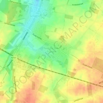
Name: Niel-bij-Sint-Truiden topographic map, elevation, terrain.

Location: Niel-bij-Sint-Truiden, Gingelom, Hasselt, Limburg, Flanders, Belgium (50.73157 5.12529 50.74977 5.16112)

Average elevation: 97 m

Minimum elevation: 71 m

Maximum elevation: 117 m

Other topographic maps

Click on a map to view its topography, its elevation and its terrain.

Genk

Belgium > Limburg > Hasselt

Genk, Hasselt, Limburg, Flanders, 3600, Belgium

Average elevation: 69 m

Hasselt

Belgium > Limburg > Hasselt

Hasselt, Limburg, Flanders, Belgium

Average elevation: 41 m