
Thank you for supporting this site ❤️
Make a donation
Make a donation
Gear up for your next adventure:
As an Amazon Associate, this site earns from qualifying purchases at no extra cost to you.
Genk topographic map
Click on the map to display elevation.
Thank you for supporting this site ❤️
Make a donation
Make a donation
Gear up for your next adventure:
As an Amazon Associate, this site earns from qualifying purchases at no extra cost to you.
About this map
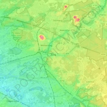
Name: Genk topographic map, elevation, terrain.
Location: Genk, Hasselt, Limburg, Flanders, 3600, Belgium (50.91305 5.38432 51.02077 5.59516)
Average elevation: 69 m
Minimum elevation: 27 m
Maximum elevation: 162 m
Thank you for supporting this site ❤️
Make a donation
Make a donation
Gear up for your next adventure:
As an Amazon Associate, this site earns from qualifying purchases at no extra cost to you.