Geolocate

Towson topographic map

Click on the map to display elevation.

About this map
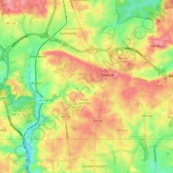
Name: Towson topographic map, elevation, terrain.

Location: Towson, Baltimore County, Maryland, United States (39.37196 -76.66714 39.42101 -76.56303)

Average elevation: 114 m

Minimum elevation: 56 m

Maximum elevation: 168 m

Gear up for your next adventure:

🥽Outdoor Goggles - Protective eyewear for outdoor activities
🧰Emergency Multi-Tool - Compact multi-tool for outdoor survival
💧Hydration Bladder - Hands-free hydration solution for long treks
🛌Insulated Sleeping Pad - Critical thermal barrier between you and the cold ground
🥾Lightweight Hiking Boots - Boots for comfort and mobility on long hikes

As an Amazon Associate, this site earns from qualifying purchases at no extra cost to you.