Geolocate

Éternoz topographic map

Click on the map to display elevation.

About this map
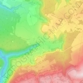
Name: Éternoz topographic map, elevation, terrain.

Location: Éternoz, Éternoz-Vallée-du-Lison, Besançon, Doubs, Bourgogne-Franche-Comté, France métropolitaine, 25330, France (46.98764 6.00950 47.02764 6.04950)

Average elevation: 562 m

Minimum elevation: 360 m

Maximum elevation: 750 m

Other topographic maps

Click on a map to view its topography, its elevation and its terrain.

Gear up for your next adventure:

🧴Outdoor Sunscreen - High SPF protection for high-altitude UV exposure
🥫Freeze-Dried Meals - Lightweight, high-calorie nutrition for multi-day treks
🧭Orienteering Kit - Tools for map reading and navigation in the wild
🔥Emergency Fire Starter - Reliable ignition source for all weather conditions
📷Outdoor Action Camera - Capture high-elevation views and rugged adventures

As an Amazon Associate, this site earns from qualifying purchases at no extra cost to you.