
Alliston topographic map
Click on the map to display elevation.
About this map
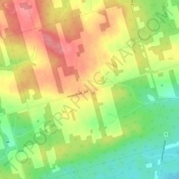
Name: Alliston topographic map, elevation, terrain.
Location: Alliston, Kings County, Prince Edward Island, Canada (46.03628 -62.64907 46.07296 -62.60094)
Average elevation: 60 m
Minimum elevation: 12 m
Maximum elevation: 104 m
Kings County trails, hiking, mountain biking, running and outdoor activities
Other topographic maps
Click on a map to view its topography, its elevation and its terrain.
Prince Edward Island National Park
Canada > Prince Edward Island > Kings County > Greenwich
Average elevation: 2 m