Geolocate

Otley topographic map

Click on the map to display elevation.

About this map

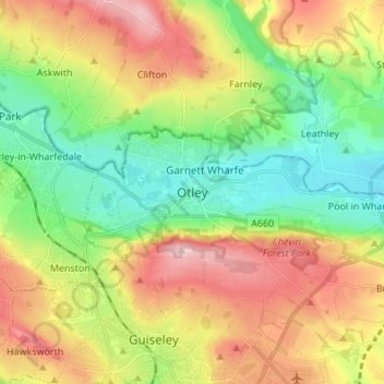
Name: Otley topographic map, elevation, terrain.

Location: Otley, Yorkshire and the Humber, England, LS21, United Kingdom (53.86551 -1.73389 53.94551 -1.65389)

Average elevation: 141 m

Minimum elevation: 42 m

Maximum elevation: 281 m

Gear up for your next adventure:

👖Convertible Hiking Pants - Zip-off legs to adapt to changing weather conditions
🔦LED Headtorch - Bright and durable light for night activities
🥾Durable Hiking Shoes - Long-lasting shoes for frequent hiking
🧥Waterproof Hiking Jacket - Protect yourself from rain and wind while hiking
🥾Hiking Leggings - Comfortable leggings for outdoor activities

As an Amazon Associate, this site earns from qualifying purchases at no extra cost to you.