Geolocate

Drumheller topographic map

Click on the map to display elevation.

About this map

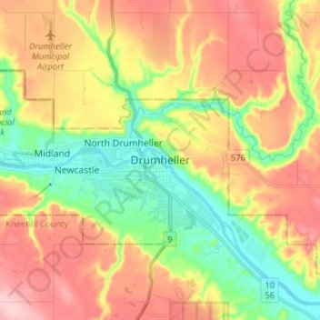
Name: Drumheller topographic map, elevation, terrain.

Location: Drumheller, Alberta, T0J 0Y2, Canada (51.42628 -112.74466 51.50628 -112.66466)

Average elevation: 763 m

Minimum elevation: 675 m

Maximum elevation: 858 m

Drumheller trails, hiking, mountain biking, running and outdoor activities

Gear up for your next adventure:

🔋Emergency Crank Radio - Weather alerts and power without needing batteries
🧢Sun Hat - Wide-brim hat for sun protection
💡LED Headlamp - Hands-free illumination for night hiking and camping
🧢Hiking Sun Hat - Wide-brimmed protection for exposed mountain ridges
🚲Handlebar Phone Mount - View topographic-map.com live while cycling

As an Amazon Associate, this site earns from qualifying purchases at no extra cost to you.