Geolocate

Bayrischzell topographic map

Click on the map to display elevation.

Bayrischzell

Bayrischzell is located in the Mangfallgebirge between Schliersee in the West and Oberaudorf in the East. It is located at the foot of Wendelstein mountain, at the foot of Sudelfeld and below the Sudelfeld pass. It lies at the northern exit of Ursprungtal. It is 23 kilometres (14 mi) southeast of Miesbach, 25 kilometres (16 mi) northwest of Kufstein, 20 kilometres (12 mi) west of Oberaudorf. In the west of the municipality, near the border with the Schliersee municipality, is the Taubensteinhaus at 1,567 metres (5,141 ft) altitude.

Wikipedia (CC-BY-SA 3.0)

About this map

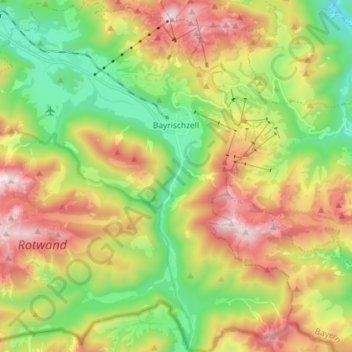
Name: Bayrischzell topographic map, elevation, terrain.

Location: Bayrischzell, Landkreis Miesbach, Bavaria, 83735, Germany (47.61107 11.91871 47.70802 12.06251)

Average elevation: 1,145 m

Minimum elevation: 646 m

Maximum elevation: 1,829 m

Other topographic maps

Click on a map to view its topography, its elevation and its terrain.

Gotzing

Germany > Bavaria > Landkreis Miesbach > Weyarn

Average elevation: 695 m

Sandbichl

Germany > Bavaria > Landkreis Miesbach > Marbach

Average elevation: 832 m

Buch

Germany > Bavaria > Landkreis Miesbach > Bad Wiessee

Average elevation: 904 m

Floiger

Germany > Bavaria > Landkreis Miesbach > Miesbach

Average elevation: 769 m

Kalten

Germany > Bavaria > Landkreis Miesbach > Niklasreuth

Average elevation: 682 m

Bergham

Germany > Bavaria > Landkreis Miesbach > Otterfing > Bergham

Average elevation: 679 m

Gear up for your next adventure:

🧳Compression Sacks - Maximize space in your backpack by shrinking gear
🔦LED Headlamp - Hands-free lighting for early morning starts or late finishes
🔦LED Flashlight - Powerful and long-lasting flashlight for camping and emergencies
🥾Light Trekking Boots - Supportive boots for multi-day treks
📷Outdoor Action Camera - Capture high-elevation views and rugged adventures

As an Amazon Associate, this site earns from qualifying purchases at no extra cost to you.