Geolocate

Winnemucca topographic map

Click on the map to display elevation.

About this map

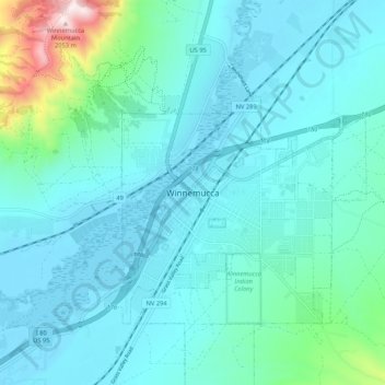
Name: Winnemucca topographic map, elevation, terrain.

Location: Winnemucca, Humboldt County, Nevada, 89445, United States (40.93243 -117.77482 41.01243 -117.69482)

Average elevation: 1,403 m

Minimum elevation: 1,298 m

Maximum elevation: 2,058 m

Gear up for your next adventure:

🪑Insulated Seat Pad - Protect your seat from cold rocks and wet logs
🧰Multitool Knife - Compact and versatile tool for outdoor use
🥾Trail Hiking Shoes - Durable shoes designed for rugged trails
🧭GPS Outdoor Watch - Smart watch for navigation and fitness tracking in nature
🕯️Camping Lantern - Illuminates your entire campsite with high-efficiency LEDs

As an Amazon Associate, this site earns from qualifying purchases at no extra cost to you.