
Thank you for supporting this site ❤️
Make a donation
Make a donation
Gear up for your next adventure:
As an Amazon Associate, this site earns from qualifying purchases at no extra cost to you.
Svartbyn topographic map
Click on the map to display elevation.
Thank you for supporting this site ❤️
Make a donation
Make a donation
Gear up for your next adventure:
As an Amazon Associate, this site earns from qualifying purchases at no extra cost to you.
About this map
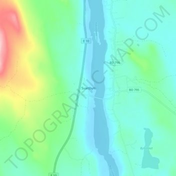
Name: Svartbyn topographic map, elevation, terrain.
Location: Svartbyn, Överkalix kommun, Norrbotten County, 956 93, Sweden (66.23963 22.80036 66.27963 22.84036)
Average elevation: 73 m
Minimum elevation: 34 m
Maximum elevation: 208 m
Thank you for supporting this site ❤️
Make a donation
Make a donation
Gear up for your next adventure:
As an Amazon Associate, this site earns from qualifying purchases at no extra cost to you.