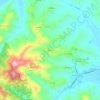
Rocca Grimalda topographic map
Click on the map to display elevation.
About this map

Name: Rocca Grimalda topographic map, elevation, terrain.
Location: Rocca Grimalda, Alessandria, Piedmont, 15078, Italy (44.65991 8.60636 44.71479 8.67118)
Average elevation: 220 m
Minimum elevation: 135 m
Maximum elevation: 367 m
Other topographic maps
Click on a map to view its topography, its elevation and its terrain.


Regione Sant'Ambrogio
Italy > Piedmont > Alessandria > Casale Monferrato > San Germano
Average elevation: 136 m