Geolocate

Mismi topographic map

Click on the map to display elevation.

About this map

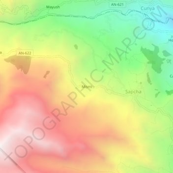
Name: Mismi topographic map, elevation, terrain.

Location: Mismi, Sapcha, Acochaca, Province of Asunción, Ancash, Peru (-9.09432 -77.42162 -9.05432 -77.38162)

Average elevation: 3,596 m

Minimum elevation: 2,841 m

Maximum elevation: 4,313 m

Gear up for your next adventure:

🎒Fully Waterproof Backpack - Total protection for photography gear and electronics
👟Sport Hiking Sandals - Breathable footwear for water crossings and camp rest
🧰Multitool Knife - Compact and versatile tool for outdoor use
🧥Ultralight Puffy Jacket - Maximum warmth that packs down to the size of an orange
🛌Insulated Sleeping Pad - Critical thermal barrier between you and the cold ground

As an Amazon Associate, this site earns from qualifying purchases at no extra cost to you.