
Pai topographic map
Interactive map
Click on the map to display elevation.
About this map
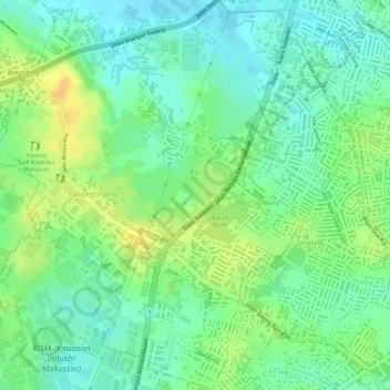
Name: Pai topographic map, elevation, terrain.
Location: Pai, Biringkanaya, Makassar, Sulawesi du Sud, Indonésie (-5.10411 119.50281 -5.07454 119.52790)
Average elevation: 15 m
Minimum elevation: 1 m
Maximum elevation: 32 m
Other topographic maps
Click on a map to view its topography, its elevation and its terrain.
Lajangiru
Indonésie > Sulawesi du Sud > Makassar
Lajangiru, Ujung Pandang, Makassar, Sulawesi du Sud, Indonésie
Average elevation: 7 m