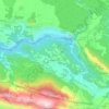
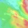
Grad Trilj topographic map
Click on the map to display elevation.
Grad Trilj
Fort Čačvina is a fortification that guarded approach from Bosnia during the wars with the Ottomans. It is situated 8 kilometres (5 mi) from the town at an altitude of 705 metres (2,313 ft) in a strategic location enabling its crew to oversee traffic of goods through the mountain passage that goes through the Dinaric Alps and leads to Bosnia. The first written record of this fortification dates to 1371.
About this map

Name: Grad Trilj topographic map, elevation, terrain.
Location: Grad Trilj, Split-Dalmatia County, Croatia (43.52270 16.65049 43.68567 16.97642)
Average elevation: 533 m
Minimum elevation: 62 m
Maximum elevation: 1,795 m
Other topographic maps
Click on a map to view its topography, its elevation and its terrain.