
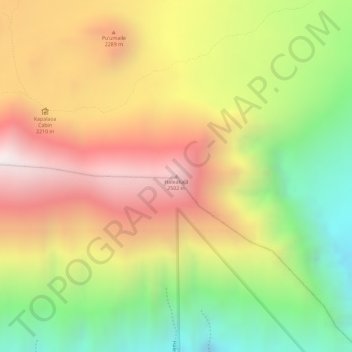
Haleakalā topographic map
Interactive map
Click on the map to display elevation.
About this map
Name: Haleakalā topographic map, elevation, terrain.
Location: Haleakalā, Maui County, Hawaii, United States (20.70144 -156.17333 20.70154 -156.17323)
Average elevation: 2,085 m
Minimum elevation: 1,560 m
Maximum elevation: 2,544 m
Other topographic maps
Click on a map to view its topography, its elevation and its terrain.
Lānaʻi
United States > Hawaii > Maui County
The highest point in Lanai is Mount Lānaʻihale. It is an inactive volcano near the center of the island and to the east of Lanai City. The elevation of Mount Lānaʻihale is 3,366 ft (1,026 m).
Average elevation: 162 m