Geolocate

Șerani topographic map

Interactive map

Click on the map to display elevation.

About this map

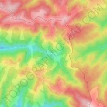
Name: Șerani topographic map, elevation, terrain.

Location: Șerani, Borod, Bihor, 417069, Roumanie (47.01841 22.66098 47.05841 22.70098)

Average elevation: 648 m

Minimum elevation: 462 m

Maximum elevation: 787 m

Other topographic maps

Click on a map to view its topography, its elevation and its terrain.

Șuncuiuș

Roumanie > Bihor

Șuncuiuș, Bihor, Roumanie

Average elevation: 574 m

Stâna de Vale

Roumanie > Bihor

Stâna de Vale, Budureasa, Bihor, Roumanie

Average elevation: 1,195 m

Bulz

Roumanie > Bihor

Bulz, Bihor, 417110, Roumanie

Average elevation: 553 m

Bicaci

Roumanie > Bihor

Bicaci, Gepiu, Bihor, 417148, Roumanie

Average elevation: 114 m

Cuzap

Roumanie > Bihor

Cuzap, Popești, Bihor, 417393, Roumanie

Average elevation: 261 m

Rohani

Roumanie > Bihor > Rohani

Rohani, Bihor, 417132, Roumanie

Average elevation: 140 m

Oradea

Roumanie > Bihor

Oradea, Zona Metropolitană Oradea, Bihor, Roumanie

Average elevation: 147 m

Oradea

Roumanie > Bihor

Oradea, Zona Metropolitană Oradea, Bihor, Roumanie

Average elevation: 144 m