
Stâna de Vale topographic map
Interactive map
Click on the map to display elevation.
About this map
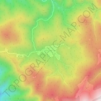
Name: Stâna de Vale topographic map, elevation, terrain.
Location: Stâna de Vale, Budureasa, Bihor, Roumanie (46.67054 22.60110 46.71054 22.64110)
Average elevation: 1,195 m
Minimum elevation: 793 m
Maximum elevation: 1,563 m
Other topographic maps
Click on a map to view its topography, its elevation and its terrain.