
Bedrock topographic map
Click on the map to display elevation.
About this map
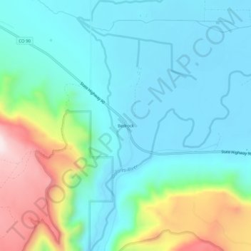
Name: Bedrock topographic map, elevation, terrain.
Location: Bedrock, Montrose County, Colorado, 81411, United States (38.29499 -108.91094 38.33499 -108.87094)
Average elevation: 1,635 m
Minimum elevation: 1,507 m
Maximum elevation: 2,027 m
Other topographic maps
Click on a map to view its topography, its elevation and its terrain.
Black Canyon of the Gunnison National Park
United States > Colorado > Montrose County
Average elevation: 2,225 m
Black Canyon of the Gunnison Wilderness
United States > Colorado > Montrose County
Average elevation: 2,163 m
Black Canyon of the Gunnison National Park
United States > Colorado > Montrose County
Average elevation: 2,225 m