Geolocate

Short Pump topographic map

Click on the map to display elevation.

About this map
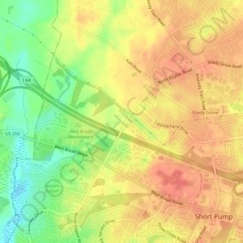
Name: Short Pump topographic map, elevation, terrain.

Location: Short Pump, Henrico County, Virginia, United States (37.64953 -77.64600 37.68024 -77.59988)

Average elevation: 75 m

Minimum elevation: 41 m

Maximum elevation: 97 m

Gear up for your next adventure:

🔦LED Flashlight - Powerful and long-lasting flashlight for camping and emergencies
🔭Compact Monocular - One-handed bird watching and trail spotting
🪑Insulated Seat Pad - Protect your seat from cold rocks and wet logs
🛶Waterproof Dry Bags - Keep electronics and clothes dry during river crossings
🧦Crew Hiking Socks - Comfortable socks for long-distance hikes

As an Amazon Associate, this site earns from qualifying purchases at no extra cost to you.