Geolocate

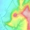
Lockwood topographic map

Click on the map to display elevation.

About this map

Name: Lockwood topographic map, elevation, terrain.

Location: Lockwood, Redcar and Cleveland, Tees Valley, England, United Kingdom (54.48800 -1.02048 54.56313 -0.89420)

Average elevation: 179 m

Minimum elevation: 16 m

Maximum elevation: 327 m

Other topographic maps

Click on a map to view its topography, its elevation and its terrain.

Stanghow

United Kingdom > England > Redcar and Cleveland

Average elevation: 171 m

Lazenby

United Kingdom > England > Redcar and Cleveland

Average elevation: 66 m

Liverton

United Kingdom > England > Redcar and Cleveland > Loftus

Average elevation: 140 m

Boulby

United Kingdom > England > Redcar and Cleveland > Loftus

Average elevation: 68 m

Gear up for your next adventure:

🥾Mountaineering Boots - Supportive boots for climbing and high-altitude hiking
🔋Emergency Crank Radio - Weather alerts and power without needing batteries
👖Convertible Hiking Pants - Zip-off legs to adapt to changing weather conditions
🥾Trail Hiking Socks - Comfortable socks to prevent blisters and fatigue
🧭GPS Handheld Device - Reliable GPS navigation for outdoor adventures

As an Amazon Associate, this site earns from qualifying purchases at no extra cost to you.