
Farmville topographic map
Click on the map to display elevation.
About this map
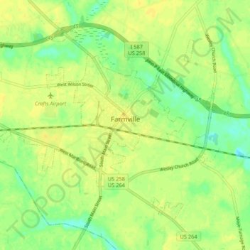
Name: Farmville topographic map, elevation, terrain.
Location: Farmville, Pitt County, North Carolina, 27828, United States (35.56855 -77.63701 35.61902 -77.55554)
Average elevation: 24 m
Minimum elevation: 11 m
Maximum elevation: 31 m
Other topographic maps
Click on a map to view its topography, its elevation and its terrain.
Hartington and Williams
United States > North Carolina > Pitt County > Greenville
Average elevation: 13 m
Hartington and Williams
United States > North Carolina > Pitt County > Greenville > Hartington and Williams
Average elevation: 13 m