Geolocate

Worth topographic map

Click on the map to display elevation.

About this map

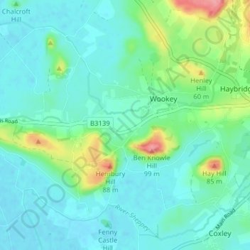
Name: Worth topographic map, elevation, terrain.

Location: Worth, Wookey, Somerset, England, BA5 1LQ, United Kingdom (51.18501 -2.72077 51.22501 -2.68077)

Average elevation: 25 m

Minimum elevation: 4 m

Maximum elevation: 99 m

Gear up for your next adventure:

🗺️Topographic Maps - Detailed maps to explore trails, mountains, and wilderness areas
🛌Insulated Sleeping Pad - Critical thermal barrier between you and the cold ground
🧢Hiking Hat - Sun-protective and breathable hats for long treks
🧣Merino Neck Gaiter - Protects against wind, sun, and cold at high altitudes
🔥Emergency Fire Starter - Reliable ignition source for all weather conditions

As an Amazon Associate, this site earns from qualifying purchases at no extra cost to you.