Geolocate

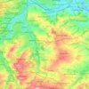
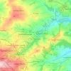
Lascelles Hall topographic map

Click on the map to display elevation.

About this map

Name: Lascelles Hall topographic map, elevation, terrain.

Location: Lascelles Hall, Kirklees, West Yorkshire, England, HD5 0BE, United Kingdom (53.62536 -1.74581 53.66536 -1.70581)

Average elevation: 125 m

Minimum elevation: 53 m

Maximum elevation: 203 m

Other topographic maps

Click on a map to view its topography, its elevation and its terrain.
Denby Dale

United Kingdom > England > Kirklees > Scissett

Average elevation: 168 m

Holmfirth Branch

United Kingdom > England > Kirklees > Brockholes

Average elevation: 185 m

Meltham

United Kingdom > England > Kirklees

Average elevation: 278 m

Mirfield

United Kingdom > England > Kirklees > Lower Hopton

Average elevation: 97 m

Kirkburton

United Kingdom > England > Kirklees

Average elevation: 148 m

Holme Valley

United Kingdom > England > Kirklees > Holmfirth

Average elevation: 290 m

Greenhead Park

United Kingdom > England > Kirklees > Huddersfield

Average elevation: 119 m

Hey Wood

United Kingdom > England > Kirklees > Farnley Tyas

Average elevation: 186 m

Crow Nest Park

United Kingdom > England > Kirklees > Dewsbury

Average elevation: 64 m

Denby Dale

United Kingdom > England > Kirklees

Average elevation: 187 m

Gear up for your next adventure:

🧼Travel Hand Sanitizer - Keep hands clean when water is scarce
⛺Tent Footprint - Protect tent floor and increase durability
🥾Hiking Boots - Sturdy boots providing ankle support and traction on rugged trails
👟Trail Running Shoes - Agile footwear for fast-paced topographic exploration
🧥Ultralight Puffy Jacket - Maximum warmth that packs down to the size of an orange

As an Amazon Associate, this site earns from qualifying purchases at no extra cost to you.