Geolocate

Lineville topographic map

Click on the map to display elevation.

About this map

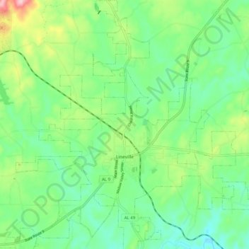
Name: Lineville topographic map, elevation, terrain.

Location: Lineville, Clay County, Alabama, United States (33.27947 -85.79829 33.36323 -85.70170)

Average elevation: 315 m

Minimum elevation: 255 m

Maximum elevation: 449 m

Other topographic maps

Click on a map to view its topography, its elevation and its terrain.

Bluff Springs

United States > Alabama > Clay County

Average elevation: 245 m

London Mountain

United States > Alabama > Clay County

Average elevation: 366 m

East Mill

United States > Alabama > Clay County > East Mill

Average elevation: 256 m

Gear up for your next adventure:

🥾Mountain Trail Shoes - High-traction shoes for mountain trails
🕯️Camping Lantern - Illuminates your entire campsite with high-efficiency LEDs
🥾Waterproof Hiking Boots - Boots keeping your feet dry in wet conditions
🧦Crew Hiking Socks - Comfortable socks for long-distance hikes
🛏️Camping Sleeping Mat - Comfortable mats for sleeping outdoors

As an Amazon Associate, this site earns from qualifying purchases at no extra cost to you.