Geolocate

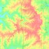
Beagle topographic map

Click on the map to display elevation.

About this map

Name: Beagle topographic map, elevation, terrain.

Location: Beagle, Miami County, Kansas, United States (38.39807 -94.97497 38.43807 -94.93497)

Average elevation: 291 m

Minimum elevation: 269 m

Maximum elevation: 325 m

Other topographic maps

Click on a map to view its topography, its elevation and its terrain.
Paola

United States > Kansas > Miami County

Average elevation: 280 m

Louisburg

United States > Kansas > Miami County

Average elevation: 316 m

Louisburg

United States > Kansas > Miami County

Average elevation: 316 m

Paola

United States > Kansas > Miami County

Average elevation: 280 m

Fontana

United States > Kansas > Miami County

Average elevation: 276 m

Spring Hill

United States > Kansas > Miami County > Spring Hill

Average elevation: 320 m

Gear up for your next adventure:

🥾Trail Running Boots - Durable shoes designed for trail running
🧥Softshell Jacket - Windproof and breathable jacket for hiking
🥾Hiking Leggings - Comfortable leggings for outdoor activities
🌡️Emergency Mylar Blankets - Compact thermal protection for unexpected nights outdoors
🔨Vehicle Emergency Tool - Safety tool for remote road trips to trailheads

As an Amazon Associate, this site earns from qualifying purchases at no extra cost to you.