Geolocate

Fangataufa topographic map

Click on the map to display elevation.

About this map
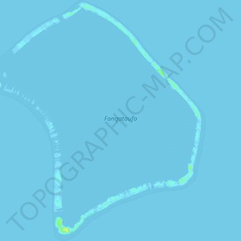
Name: Fangataufa topographic map, elevation, terrain.

Location: Fangataufa, Tureia, Tuamotu-Gambier, French Polynesia, 98784, France (-22.28376 -138.79274 -22.19446 -138.70150)

Average elevation: 0 m

Minimum elevation: -1 m

Maximum elevation: 16 m

Other topographic maps

Click on a map to view its topography, its elevation and its terrain.

Moruroa

France > French Polynesia > Tureia

Average elevation: 0 m

Tematangi

France > French Polynesia > Tureia

Average elevation: 0 m

Tureia

France > French Polynesia > Tureia

Average elevation: 0 m

Vanavana

France > French Polynesia > Tureia

Average elevation: 0 m

Vanavana

France > French Polynesia > Tureia

Average elevation: 0 m

Gear up for your next adventure:

🥘Camping Cookware Set - Compact nesting pots and pans for trail cooking
🧭Orienteering Kit - Tools for map reading and navigation in the wild
🧥Softshell Hiking Jacket - The perfect balance of wind protection and breathability
🔪Outdoor Multitool - Versatile tool for repairs and food prep in the wild
🥾Waterproof Hiking Shoes - Durable shoes for wet and rugged trails

As an Amazon Associate, this site earns from qualifying purchases at no extra cost to you.