Geolocate

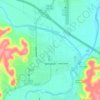
Noxville topographic map

Click on the map to display elevation.

About this map

Name: Noxville topographic map, elevation, terrain.

Location: Noxville, Kimble County, Texas, United States (30.36991 -99.48728 30.40991 -99.44728)

Average elevation: 641 m

Minimum elevation: 589 m

Maximum elevation: 695 m

Other topographic maps

Click on a map to view its topography, its elevation and its terrain.
Junction

United States > Texas > Kimble County

Average elevation: 532 m

Junction

United States > Texas > Kimble County

Average elevation: 532 m

Junction

United States > Texas > Kimble County

Average elevation: 532 m

Gear up for your next adventure:

🏃Hydration Running Vest - Carry water and maps close to your body for speed
🧢Outdoor Visor - Breathable visor for sunny hikes
🥾Trail Hiking Socks - Comfortable socks to prevent blisters and fatigue
🛌Insulated Sleeping Pad - Critical thermal barrier between you and the cold ground
💡LED Headlamp - Hands-free illumination for night hiking and camping

As an Amazon Associate, this site earns from qualifying purchases at no extra cost to you.