Geolocate

Bentley topographic map

Click on the map to display elevation.

About this map
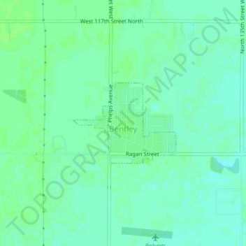
Name: Bentley topographic map, elevation, terrain.

Location: Bentley, Sedgwick County, Kansas, United States (37.88231 -97.52400 37.89115 -97.50966)

Average elevation: 424 m

Minimum elevation: 419 m

Maximum elevation: 427 m

Gear up for your next adventure:

🧥Waterproof Pants - Keep dry during rainy hiking conditions
🧥Softshell Jacket - Windproof and breathable jacket for hiking
🔦LED Headlamp - Hands-free lighting for early morning starts or late finishes
🥾Trail Hiking Shoes - Durable shoes designed for rugged trails
🛰️Satellite Messenger - Emergency communication for areas with no cell service

As an Amazon Associate, this site earns from qualifying purchases at no extra cost to you.