Geolocate

Dogmersfield topographic map

Click on the map to display elevation.

About this map

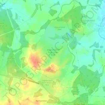
Name: Dogmersfield topographic map, elevation, terrain.

Location: Dogmersfield, Hart, Hampshire, England, United Kingdom (51.24620 -0.91889 51.27777 -0.86890)

Average elevation: 83 m

Minimum elevation: 64 m

Maximum elevation: 111 m

Other topographic maps

Click on a map to view its topography, its elevation and its terrain.

Brickkiln Copse

United Kingdom > England > Hampshire > Hart > Hound Green

Average elevation: 61 m

Brookly Stream

United Kingdom > England > Hampshire > Hart > Fleet

Average elevation: 78 m

Beacon Hill

United Kingdom > England > Hampshire > Hart

Average elevation: 139 m

Well

United Kingdom > England > Hampshire > Hart

Average elevation: 138 m

Phoenix Green

United Kingdom > England > Hampshire > Hart

Average elevation: 71 m

Mattingley

United Kingdom > England > Hampshire > Hart

Average elevation: 65 m

Eversley Cross

United Kingdom > England > Hampshire > Hart

Average elevation: 69 m

Hillside

United Kingdom > England > Hampshire > Hart > Odiham

Average elevation: 98 m

Murrell Green

United Kingdom > England > Hampshire > Hart > Hook

Average elevation: 73 m

Wells Hill

United Kingdom > England > Hampshire > Hart

Average elevation: 122 m

Minley

United Kingdom > England > Hampshire > Hart

Average elevation: 79 m

Gear up for your next adventure:

🚑Survival Whistle - Signal for help across long distances in mountains
🛏️Sleeping Bag - Warm and compact sleeping bags for outdoor camping
🐕Hiking Dog Pack - Let your canine companion carry their own water and food
💧Hydration Bladder - Hands-free hydration solution for long treks
🧥Ultralight Puffy Jacket - Maximum warmth that packs down to the size of an orange

As an Amazon Associate, this site earns from qualifying purchases at no extra cost to you.