Geolocate

Tameiga topographic map

Click on the map to display elevation.

About this map

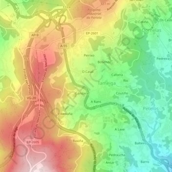
Name: Tameiga topographic map, elevation, terrain.

Location: Tameiga, Mos, Vigo, Pontevedra, Galicia, 36416, Spain (42.18134 -8.66908 42.21466 -8.63246)

Average elevation: 234 m

Minimum elevation: 53 m

Maximum elevation: 431 m

Gear up for your next adventure:

🔦LED Headlamp - Hands-free lighting for early morning starts or late finishes
Camping Tent - Weather-resistant tents suitable for 2 to 6 people
🐕Hiking Dog Pack - Let your canine companion carry their own water and food
🧴Insect Repellent - Protect yourself from bugs during outdoor adventures
🥾Trail Hiking Shoes - Durable shoes designed for rugged trails

As an Amazon Associate, this site earns from qualifying purchases at no extra cost to you.