Geolocate

Tameiga topographic map

Click on the map to display elevation.

About this map
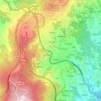
Name: Tameiga topographic map, elevation, terrain.

Location: Tameiga, Mos, Vigo, Pontevedra, Galicia, 36416, Spain (42.18134 -8.66908 42.21466 -8.63246)

Average elevation: 234 m

Minimum elevation: 53 m

Maximum elevation: 431 m

Gear up for your next adventure:

🔭Compact Monocular - One-handed bird watching and trail spotting
🥾Waterproof Hiking Shoes - Durable shoes for wet and rugged trails
🥾Lightweight Hiking Shoes - Comfortable shoes for day hikes
🥘Camping Cookware Set - Compact nesting pots and pans for trail cooking
🔥Emergency Fire Starter - Reliable ignition source for all weather conditions

As an Amazon Associate, this site earns from qualifying purchases at no extra cost to you.