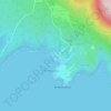
Višnjan topographic map
Click on the map to display elevation.
Višnjan
Višnjan is located 12 kilometers east of Poreč and 3 kilometers west of Pula-Koper road. Višnjan is located on elevation of 244m and average municipality elevation is between 200-300m. One of the most notable sinkholes in Istria, Baredina, is located in the municipality.
About this map

Name: Višnjan topographic map, elevation, terrain.
Location: Višnjan, Općina Višnjan, Istria County, 52463, Croatia (45.25602 13.69887 45.29602 13.73887)
Average elevation: 221 m
Minimum elevation: 133 m
Maximum elevation: 329 m
Other topographic maps
Click on a map to view its topography, its elevation and its terrain.

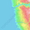

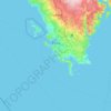
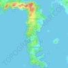












Grad Rovinj
Since records began in 1984, the highest temperature recorded at the Sveti Ivan na pučini weather station at an elevation of 8 metres (26 ft) was 34.2 °C (93.6 °F), on 5 August 2017. The coldest temperature was −6.5 °C (20.3 °F), on 29 December 1996.
Average elevation: 24 m

Grad Pazin
Since records began in 1961, the highest temperature recorded at the local weather station at an elevation of 297 metres (974 ft) was 39.5 °C (103.1 °F), on 3 August 2017. The coldest temperature was −18.7 °C (−1.7 °F), on 8 January 1985.
Average elevation: 311 m


Grad Rovinj
Since records began in 1984, the highest temperature recorded at the Sveti Ivan na pučini weather station at an elevation of 8 metres (26 ft) was 34.2 °C (93.6 °F), on 5 August 2017. The coldest temperature was −6.5 °C (20.3 °F), on 29 December 1996.
Average elevation: 24 m