Geolocate

Bale topographic map

Click on the map to display elevation.

About this map

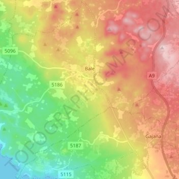
Name: Bale topographic map, elevation, terrain.

Location: Bale, Općina Bale, Istria County, 52211, Croatia (44.98582 13.70410 45.07545 13.80189)

Average elevation: 118 m

Minimum elevation: 0 m

Maximum elevation: 246 m

Other topographic maps

Click on a map to view its topography, its elevation and its terrain.

Nova Vas

Croatia > Istria County > Grad Poreč

Average elevation: 112 m

Gear up for your next adventure:

🧥Waterproof Hiking Jacket - Protect yourself from rain and wind while hiking
🥾Hiking Shoes - Durable and comfortable shoes for trail hiking
Lightweight Backpacking Tent - Compact tent for efficient hiking trips
🥾Waterproof Hiking Shoes - Durable shoes for wet and rugged trails
🛁Quick-Dry Microfiber Towel - Space-saving towel that dries rapidly on the move

As an Amazon Associate, this site earns from qualifying purchases at no extra cost to you.