Geolocate

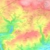
Coray topographic map

Click on the map to display elevation.

About this map

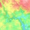
Name: Coray topographic map, elevation, terrain.

Location: Coray, Châteaulin, Finistère, Brittany, Metropolitan France, 29370, France (48.03679 -3.91551 48.10298 -3.80866)

Average elevation: 169 m

Minimum elevation: 84 m

Maximum elevation: 265 m

Other topographic maps

Click on a map to view its topography, its elevation and its terrain.
Ar Vodennic

France > Brittany > Finistère > Plomodiern

Average elevation: 67 m

Garret

France > Brittany > Finistère > Menfig

Average elevation: 7 m

Pors Elenec

France > Brittany > Finistère > Roscoff

Average elevation: 7 m

Espace du Kelenn

France > Brittany > Finistère > Carantec

Average elevation: 9 m

Park Mar

France > Brittany > Finistère > Scaër

Average elevation: 133 m

Stêr an Ale

France > Brittany > Finistère > Plomodiern

Average elevation: 95 m

Kergonvel

France > Brittany > Finistère > Plouguerneau

Average elevation: 37 m

Kermoor

France > Brittany > Finistère > Port-la-Forêt

Average elevation: 20 m

Keraudry

France > Brittany > Finistère > Guipavas

Average elevation: 82 m

Gear up for your next adventure:

🦶Hiking Shoe Insoles - Added support for high arches and long days on feet
🧥Ultralight Puffy Jacket - Maximum warmth that packs down to the size of an orange
🥾Trekking Poles - Adjustable trekking poles to reduce knee stress and improve stability
💡Portable Camping Lamp - Rechargeable lamp for campsite lighting
🥾Hiking Boots - Sturdy boots providing ankle support and traction on rugged trails

As an Amazon Associate, this site earns from qualifying purchases at no extra cost to you.