Geolocate

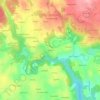
Scaër topographic maps

Click on a map to view its topography, its elevation and its terrain.

Park Mar

France > Brittany > Finistère > Scaër

Average elevation: 133 m

Gear up for your next adventure:

🛁Quick-Dry Microfiber Towel - Space-saving towel that dries rapidly on the move
🔋Emergency Crank Radio - Weather alerts and power without needing batteries
🧶550 Survival Paracord - Versatile utility cord for emergency repairs and rigging
🥾Hiking Gaiters - Protect legs and shoes from mud, snow, and debris
⛺Family Camping Tent - Spacious tent suitable for family camping trips

As an Amazon Associate, this site earns from qualifying purchases at no extra cost to you.