Geolocate

Trixie topographic map

Click on the map to display elevation.

About this map
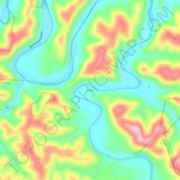
Name: Trixie topographic map, elevation, terrain.

Location: Trixie, Clay County, Kentucky, United States (37.31537 -83.68992 37.35537 -83.64992)

Average elevation: 294 m

Minimum elevation: 207 m

Maximum elevation: 430 m

Gear up for your next adventure:

🥾Trekking Boots - Durable boots for long-distance trekking
🧥Thermal Fleece Jacket - Versatile insulation for changing mountain temperatures
⛺Camping Groundsheet - Protect your tent from moisture and dirt
🧢Hiking Hat - Sun-protective and breathable hats for long treks
🥾Trail Running Boots - Durable shoes designed for trail running

As an Amazon Associate, this site earns from qualifying purchases at no extra cost to you.