Geolocate

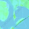
Tuffly Park topographic map

Click on the map to display elevation.

About this map

Name: Tuffly Park topographic map, elevation, terrain.

Location: Tuffly Park, 3200, Greater Fifth Ward, Houston, Harris County, Texas, 77026, United States (29.78974 -95.33374 29.79211 -95.33124)

Average elevation: 16 m

Minimum elevation: 13 m

Maximum elevation: 18 m

Other topographic maps

Click on a map to view its topography, its elevation and its terrain.
Black Cat Ridge

United States > Texas > Harris County > Houston

Average elevation: 24 m

Kingwood

United States > Texas > Harris County > Houston

Average elevation: 22 m

East Houston

United States > Texas > Harris County > Houston

Average elevation: 15 m

Kings Point

United States > Texas > Harris County > Houston

Average elevation: 20 m

Forest Cove

United States > Texas > Harris County > Houston

Average elevation: 24 m

Black Cat Ridge

United States > Texas > Harris County > Houston

Average elevation: 24 m

Gear up for your next adventure:

🔪Outdoor Multitool - Versatile tool for repairs and food prep in the wild
🥾Light Trekking Boots - Supportive boots for multi-day treks
🕶️Polarized Sunglasses - Protect your eyes with durable polarized lenses
🥾Mountain Hiking Shoes - Shoes with superior grip for mountainous terrain
🧢Sun Protection Cap - Breathable cap to protect from sun exposure

As an Amazon Associate, this site earns from qualifying purchases at no extra cost to you.