Geolocate

Bande topographic map

Click on the map to display elevation.

About this map

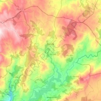
Name: Bande topographic map, elevation, terrain.

Location: Bande, A Baixa Limia, Ourense, Galicia, Spain (41.96070 -8.06438 42.08394 -7.87628)

Average elevation: 819 m

Minimum elevation: 410 m

Maximum elevation: 1,231 m

Other topographic maps

Click on a map to view its topography, its elevation and its terrain.

Martiñán

Spain > Galicia > A Baixa Limia > Bande

Average elevation: 830 m

As Quintas

Spain > Galicia > A Baixa Limia > Lobeira

Average elevation: 731 m

Gear up for your next adventure:

🧢Sun Hat - Wide-brim hat for sun protection
🔭Compact Monocular - One-handed bird watching and trail spotting
🧢Beanie Hat - Keep your head warm in cold weather
🥾All-Terrain Hiking Boots - Versatile boots for varied hiking conditions
👟Trail Running Shoes - Agile footwear for fast-paced topographic exploration

As an Amazon Associate, this site earns from qualifying purchases at no extra cost to you.