Geolocate

Spring Hill topographic map

Click on the map to display elevation.

About this map
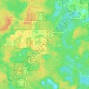
Name: Spring Hill topographic map, elevation, terrain.

Location: Spring Hill, Leon County, Florida, United States (30.31937 -84.40796 30.35937 -84.36796)

Average elevation: 23 m

Minimum elevation: 4 m

Maximum elevation: 39 m

Gear up for your next adventure:

🔦LED Headlamp - Hands-free lighting for early morning starts or late finishes
🧤Insulated Winter Gloves - Heavy-duty protection for sub-zero Canadian adventures
🥾Waterproof Hiking Shoes - Durable shoes for wet and rugged trails
🧤Thermal Hiking Gloves - Grip-enhanced gloves for cold-weather altitude trekking
🧊Insulated Water Bottle - Keeps drinks cold in summer and prevents freezing in winter

As an Amazon Associate, this site earns from qualifying purchases at no extra cost to you.