Geolocate

Cottage Grove topographic map

Click on the map to display elevation.

About this map

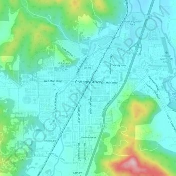
Name: Cottage Grove topographic map, elevation, terrain.

Location: Cottage Grove, Lane County, Oregon, 97424, United States (43.77765 -123.08337 43.81424 -123.02414)

Average elevation: 230 m

Minimum elevation: 178 m

Maximum elevation: 430 m

Gear up for your next adventure:

🧥Thermal Layer - Insulating layer for cold outdoor conditions
🧭GPS Handheld Device - Reliable GPS navigation for outdoor adventures
🛰️Satellite Messenger - Emergency communication for areas with no cell service
Tent Footprint - Protect tent floor and increase durability
🔭Compact Binoculars - Lightweight optics for scouting trails and wildlife

As an Amazon Associate, this site earns from qualifying purchases at no extra cost to you.