Geolocate

Rainbow topographic map

Click on the map to display elevation.

About this map

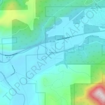
Name: Rainbow topographic map, elevation, terrain.

Location: Rainbow, Lane County, Oregon, 97413, United States (44.14677 -122.25693 44.18677 -122.21693)

Average elevation: 486 m

Minimum elevation: 349 m

Maximum elevation: 1,125 m

Gear up for your next adventure:

🔦LED Flashlight - Powerful and long-lasting flashlight for camping and emergencies
🦯Trekking Poles - Reduced impact on joints for steep topographic climbs
🧰Survival Kit - Essential gear for emergencies in the wilderness
🥾Mountain Trail Shoes - High-traction shoes for mountain trails
🥾Trail Hiking Shoes - Durable shoes designed for rugged trails

As an Amazon Associate, this site earns from qualifying purchases at no extra cost to you.